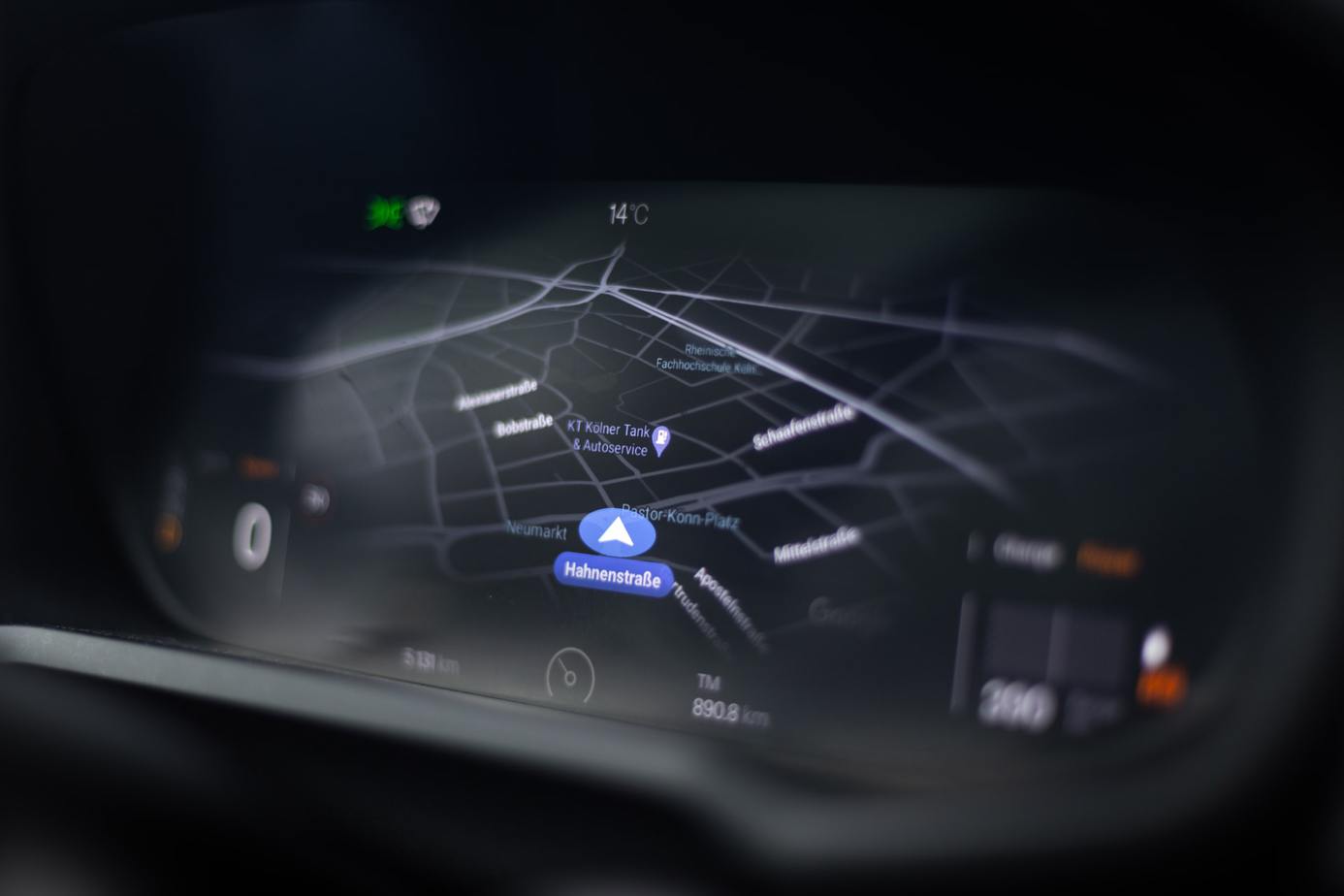
Each of us has experienced first-hand the capabilities of GPS. Navigation facilitates our everyday life to such an extent that we no longer remember the times when everyone kept a car map at hand. Nevertheless, few realize that over time, competing location systems have begun to emerge. Today we will discuss the most important ones.
While absolutely everyone has heard the enigmatic acronym GPS, few are aware of the history of this technology. The American satellite navigation system was developed for the United States Department of Defense. It consists of three components – a space segment (31 satellites), a ground segment (control stations), and a signal receiver segment
Although it sounds innocent, the original use of the system was to guide missiles with an accuracy of five meters. Over time, however, the technology’s potential for public use was recognized, and that’s how military technology has made our lives so much easier.
Since the Americans came up with the innovative idea, the Soviets – traditionally – could not remain indebted. Just three years after the invention of GPS, Russia started working on its own technology called GLONASS. There is no reason to dwell on the principle of operation, as it is very similar to its American counterpart. Importantly, however, GLONASS receivers have only recently been introduced to the public and are not very popular. Apart from a few models of popular phones, we can find this technology in a Russian electric car called Jo-Mobil. GLONASS loses to GPS in terms of accuracy – 2.8 meters to 30 centimeters margin of error.
Now that we’ve discussed the U.S. and Russian systems, it’s time for a European innovation. Galileo was launched fairly recently, in 2016. The biggest advantage of the system is its competitiveness in terms of accuracy. While the radius of error on the open frequency is a meter, it is only 10 centimeters for the paid counterpart! Since Galileo is in the development phase, 24 of the targeted 30 satellites are in orbit. Interestingly, the main reason for building a homegrown solution was the lack of trust in existing systems, which could be shut down or disrupted at any time
It is time for the last major player in the international arena – China. The Middle Kingdom has followed similar considerations in building its own localization system. The first official tests began as early as 2000, but they did not offer competitive usability. In 2020, the last planned satellite was placed in space, fulfilling the ruling party’s hopes.
The technology has a surprising accuracy for military use, which is expected to be up to a 10 centimeter radius of error. The third generation of BeiDou is now in operation, which has allowed for global location coverage. Earlier systems had a regional circle of operation – covering the territory of China and neighboring countries.
Main photo: Tobias Rademacher/unsplash.com